What is Reality Capture?
The technology that turns the real world into a precise, explorable 3D digital twin — and it's simpler than you think.
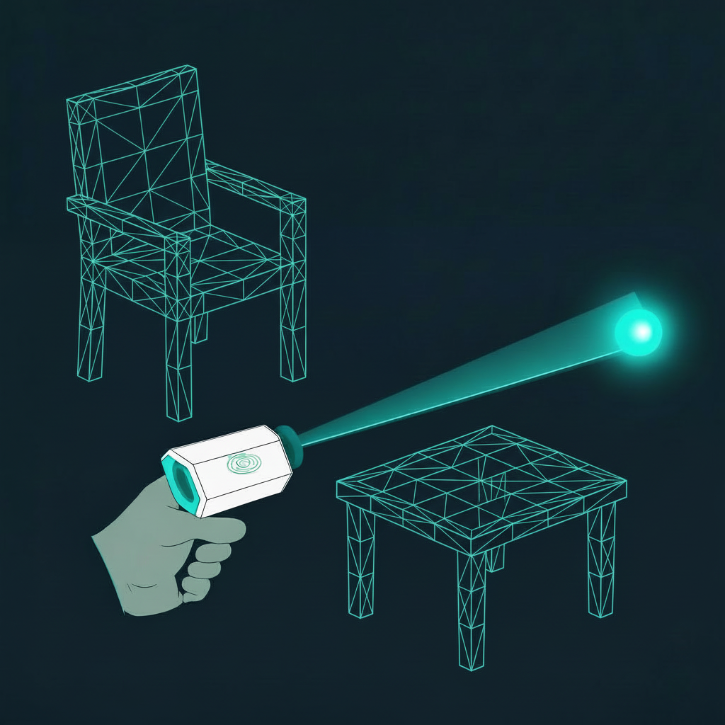
The real world, digitised.
Scan a physical space — a building, a landscape, even an entire street — and walk through a precise 3D copy of it on screen. Measure anything. Explore from any angle. That's reality capture.
Scan
Walk through a space with a handheld scanner. The device captures millions of measurements per second.
Process
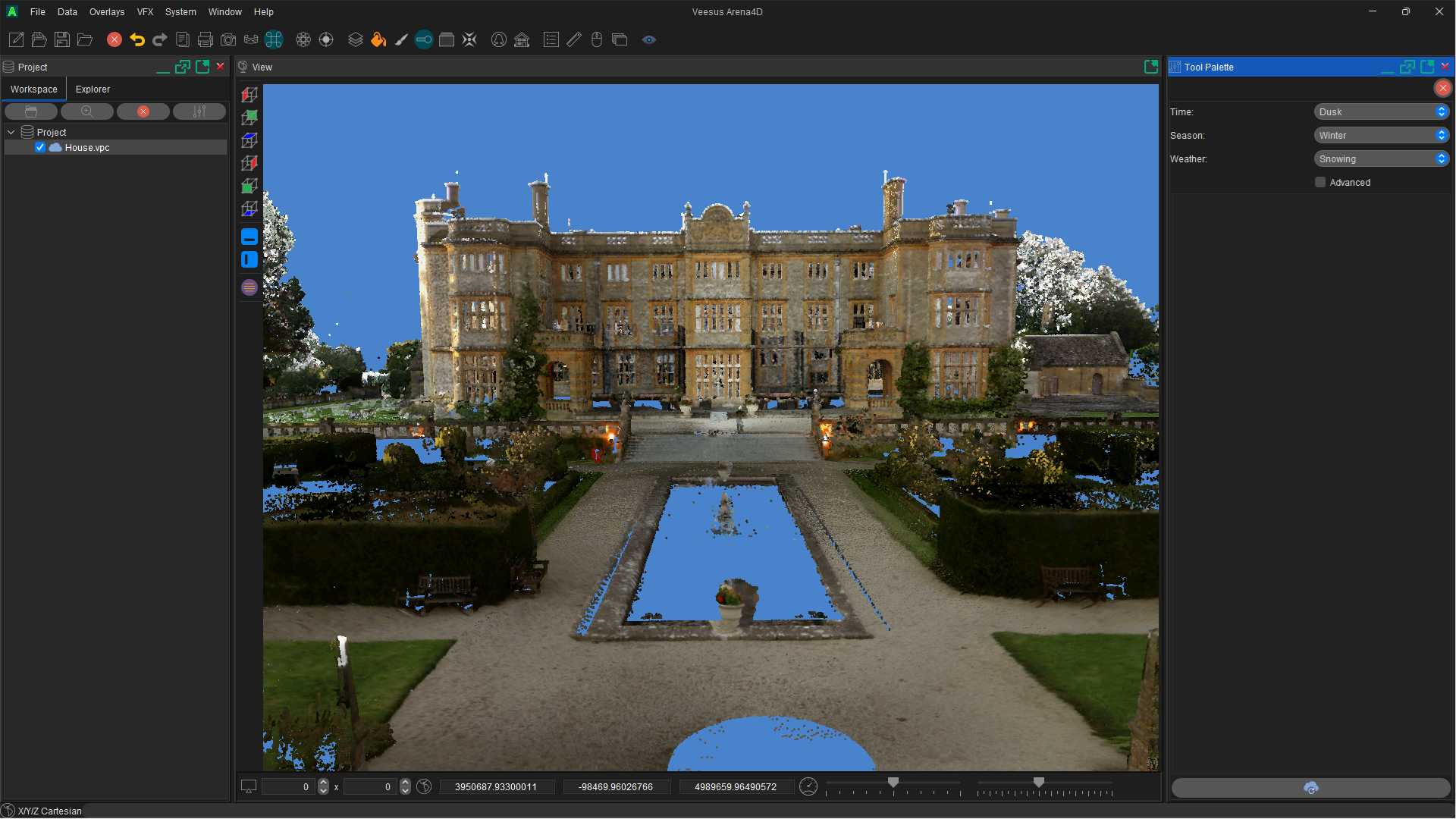
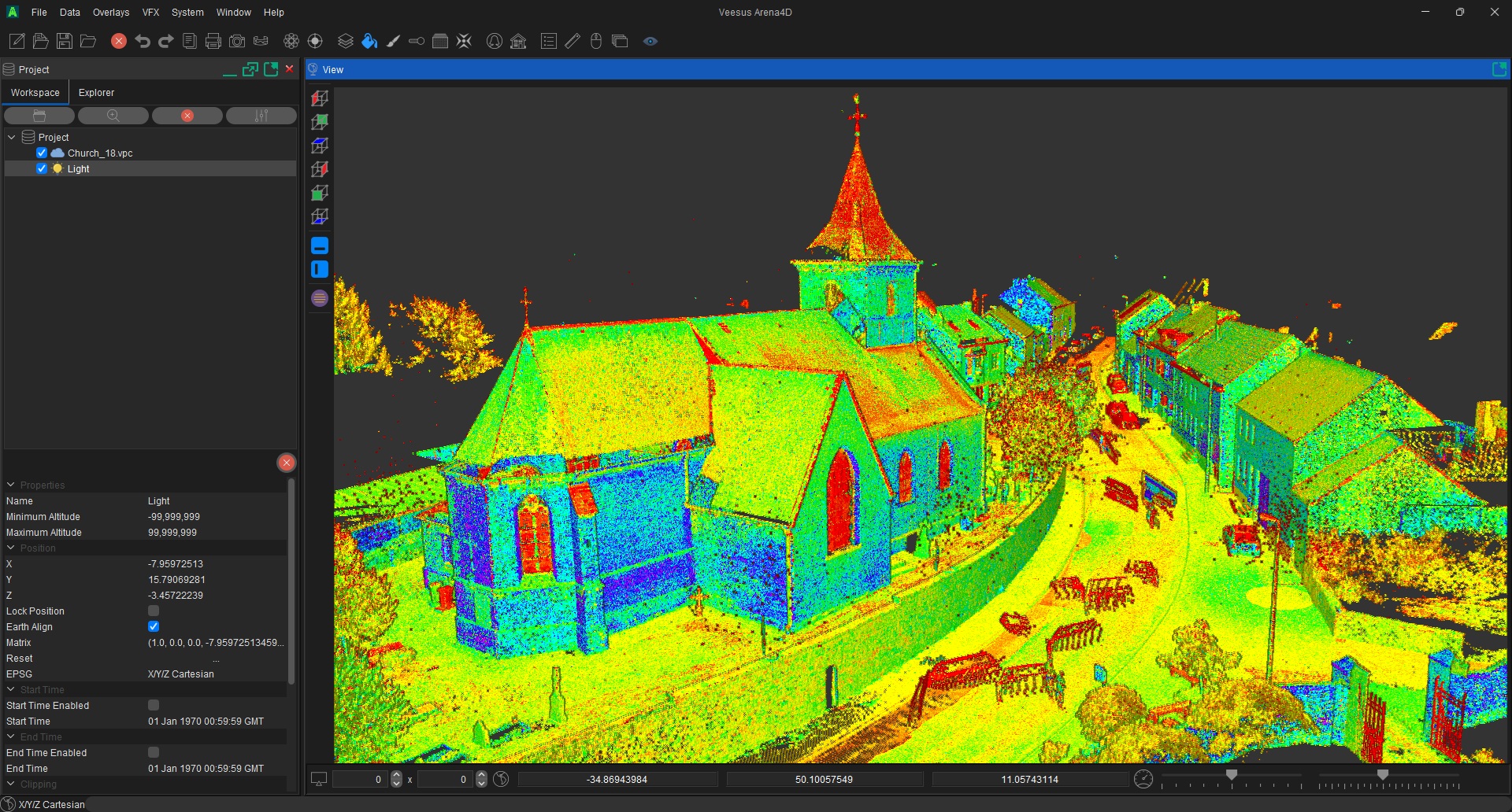
The data is processed into a detailed 3D model — either a Point Cloud or a Gaussian Splat (more on those below).
Explore
Use software to navigate, measure, animate and share your 3D data with colleagues or clients — from anywhere.
What is SLAM scanning?
SLAM stands for Simultaneous Localisation and Mapping. In plain English, the scanner works out where it is in a room at the same time as it maps everything around it — all in real-time.
Think of it like drawing a map of a building while blindfolded, but using lasers and cameras to "see" instead of your eyes. The scanner bounces lasers off every surface thousands of times per second. The result? A complete, accurate 3D model of the space — captured in minutes, not hours.
Unlike older surveying methods that need a tripod and long setup, SLAM scanners are handheld and mobile. You simply walk through a space and the scanner does the rest.
Millions of measurements captured every second
Point Clouds & Gaussian Splats.
When you scan a space, the data comes out in two forms. Both have unique strengths — and modern XGRIDS scanners produce both simultaneously.
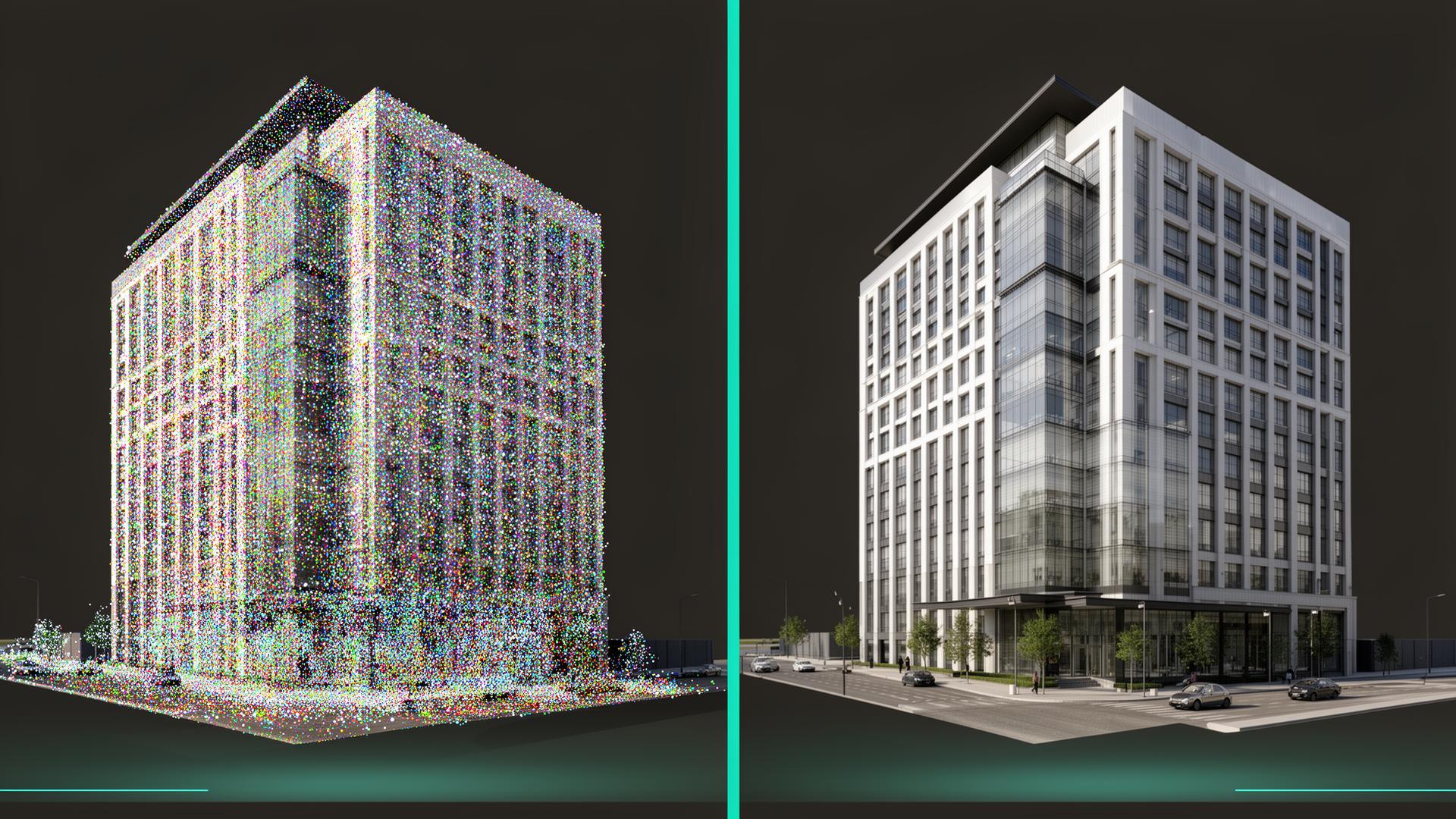
Point Clouds
Millions of individual points floating in 3D space, each with a precise position and colour. The industry standard for measurement, engineering and technical documentation.
- Millimetre-level accuracy
- Industry-standard format
- Ideal for measurement & CAD work
- Perfect for engineering documentation
Gaussian Splats
Soft, overlapping blobs of colour that blend seamlessly — like millions of tiny paint strokes creating a lifelike picture you can walk through.
- Photorealistic quality
- Stunning visual impact
- Perfect for presentations & film
- Ideal for client-facing deliverables
XGRIDS — industry-leading SLAM capture.
When it comes to handheld SLAM scanning, no one does it better. XGRIDS devices are trusted by professionals worldwide — and they partner exclusively with Veesus for a complete capture-to-visualisation workflow.
TV & Film
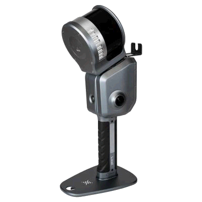
XGRIDS PortalCam
Spatial Camera
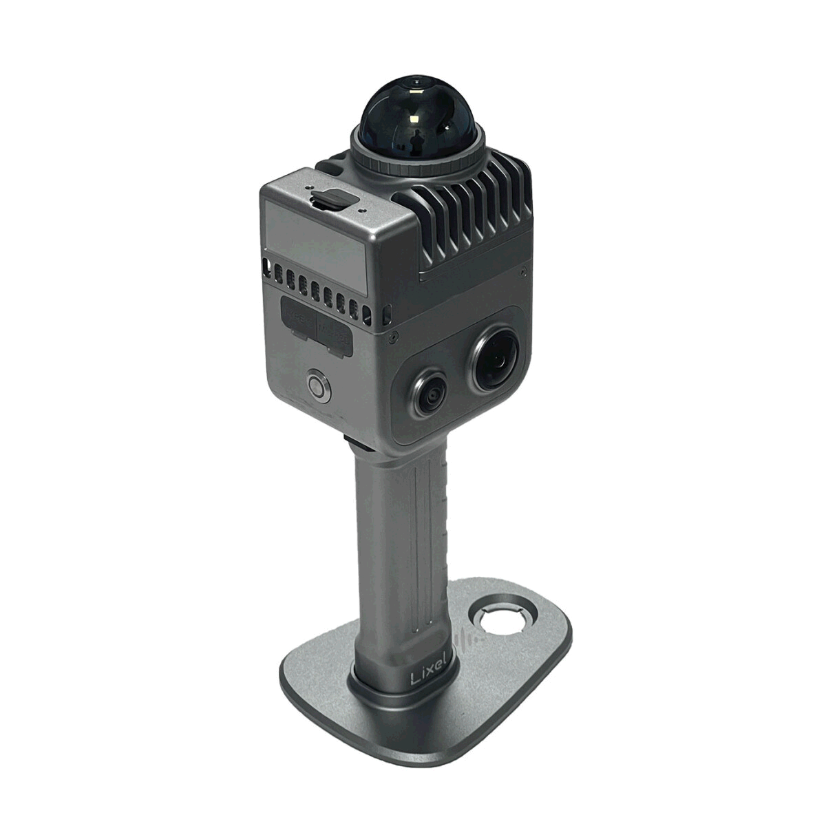
New · Pre-order
XGRIDS Lixel K2
The Gold Standard in Lightweight Scanning
Surveying
XGRIDS Lixel L2 PRO
Professional Scanner
From raw data to captivating deliverables.
Capturing data is only half the story. Veesus software transforms your Point Cloud and Gaussian Splat data into breathtaking animations, images, videos and technical drawings that impress clients and win projects.
Animations & Video
Cinematic fly-throughs and walkthroughs from your 3D data. Perfect for client presentations.

Stunning Images
Photorealistic renders and AI-enhanced visuals that bring scanned environments to life.
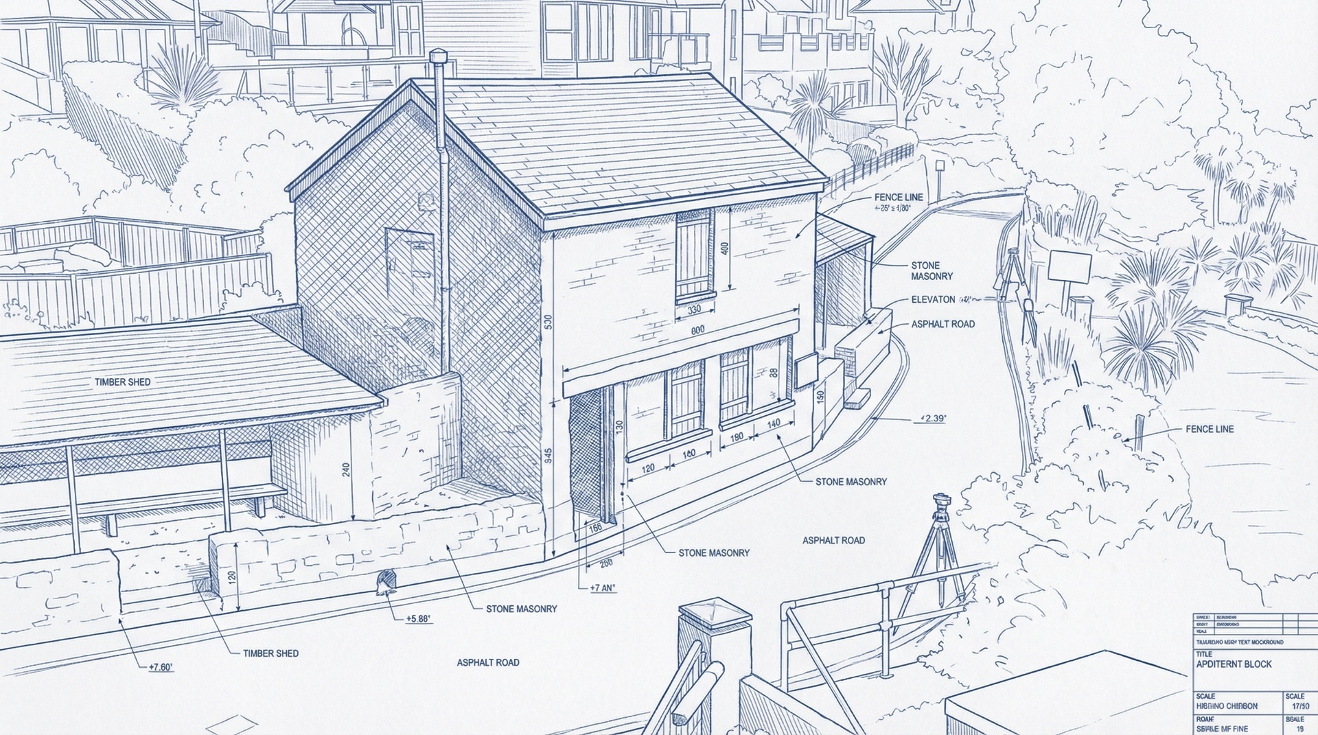
Technical Drawings
Precise CAD-ready drawings and documentation directly from your scan data.

AI-Enhanced Output
Use Arena Intelligence to transform data into seasonal, atmospheric and stylised visuals in seconds.

Why professionals choose us.
Real people, fair pricing and technology that genuinely leads its category — that's the difference.
Friendly, Accessible Support
Real people who understand your work. Industry professionals who speak your language and respond quickly — no ticket queues, no jargon.
Cost-Effective Licensing
Enterprise-grade technology without the enterprise price tag. Flexible licensing means you only pay for what you need.
Market-Leading Technology
From AI-powered visuals to seamless CAD integration — Veesus pushes the boundaries of what's possible with 3D data.
Ready to explore further?
Browse the scanners that power it all, see what our software can do, or discover how AI is reshaping reality capture.